
Before Midland: The Anishinaabe at the Forks of the Tittabawassee
- Midland History
- Origins of Midland

Origins of Midland, Part 1
Stand on the Tridge and look down. The Chippewa River slides in from the west and folds into the Tittabawassee, and together they head southeast toward Saginaw Bay. Most of us cross that spot without thinking about it. For thousands of years, that meeting of rivers was the reason people lived here at all.
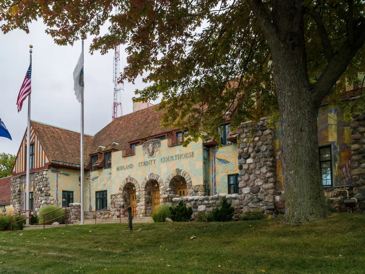
The State of Michigan’s historical marker in front of the Midland County Courthouse records that the first white settlers built a fur trading post near that site in 1831, at a place the Native people called “Little Forks.” That name is older than Midland, older than Michigan, and older than the United States. This article is about the people who gave it.
It draws on federal treaty texts, archaeological reports, the Saginaw Chippewa Indian Tribe’s own published history, nineteenth-century county histories, and modern scholarship. Where the sources disagree, or where a story rests on a single account, I say so.
The Land at the Forks
Midland sits at the confluence of the Chippewa and Tittabawassee Rivers. A few miles upstream, at what is now the Chippewa Nature Center, the Pine River joins the Chippewa. The Tittabawassee runs on to meet the Shiawassee, and together they form the Saginaw River, which empties into Saginaw Bay and Lake Huron. Before roads, this river system was the highway of central Michigan. A family in a canoe at the Forks could reach the Great Lakes, or travel west toward the interior hunting grounds, without walking more than a short portage.
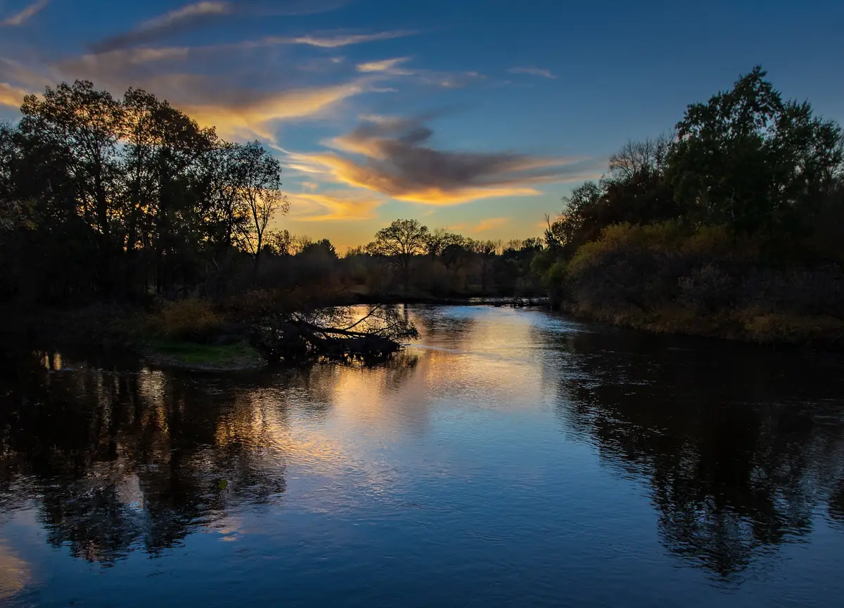

The rivers also fed people. Floodplains held fish, game, and fertile soil, and the hardwood forests on the higher ground held maple, the source of sugar. When University of Michigan archaeologist Wilbert Hinsdale compiled his Archaeological Atlas of Michigan in 1931, he wrote that the line of Native villages along the Tittabawassee extended up into Midland County, and he counted six village sites within eight miles of the city of Midland, one of them on the Pine River.
The river names themselves are inheritances. The Chippewa River carries the English name of the Ojibwe people. Virgil Vogel, in his study of Michigan’s Native place names, read Tittabawassee as describing a river that runs parallel to the shoreline of Saginaw Bay instead of straight into it. Other writers translate it differently, and no single meaning is settled.
Ten Thousand Years of Neighbors
People reached the Saginaw Valley at the end of the Ice Age. The Historical Society of Saginaw County, which runs one of the most active archaeology programs in the region, dates the Paleo-Indian period here to roughly 10,000 to 8,000 B.C., followed by the Archaic period (8,000 to 500 B.C.) and the Woodland period (about 600 B.C. into the A.D. 1600s). The landscape those first families saw was colder and different. In 1970, botanist Ronald Kapp described the bones of a Jefferson mammoth found on the Bailer farm in Midland County, an animal dated to about 24,000 years ago, long before any people arrived.
Midland County appears in the professional literature of American archaeology. In 1963 Lewis Binford, one of the most influential archaeologists of the twentieth century, published his report on the Pomranky site, a Late Archaic burial site in Midland County. A style of stone projectile point found across the eastern Great Lakes, the Pomranky point, takes its name from that site.
The richest local record sits on the grounds of the Chippewa Nature Center. The Oxbow Archeological District, listed on the National Register of Historic Places in 1973, holds sites occupied in the Middle and Late Archaic, the Late Woodland, and the historic period. Volunteers and professionals have excavated there since 1966. One site, Sias East, shows people living on the north bank of the Chippewa in the fourth century A.D. and again in the fifteenth century.
The most surprising site may be the one you have parked on. Archaeologists recorded Midland Site #8 on the floodplain near the confluence of the Chippewa and Tittabawassee. When the city built Chippewassee Park in the 1970s, the site was covered by a gravel parking lot and lawn. Samples from it were analyzed for plant residues as recently as 2019. The Tridge stands over ground that people used long before anyone wrote anything down.
Across those millennia, daily life changed slowly. Fired-clay pottery marks the start of the Woodland period in the Saginaw Valley, the bow and arrow arrived in the Late Woodland, and corn became an important food only after about A.D. 800 to 1000. The Saginaw County historical society notes that no large farming villages are known from the valley. People lived in small, scattered settlements and moved with the seasons.
The Anishinaabe and the Saginaw Bands
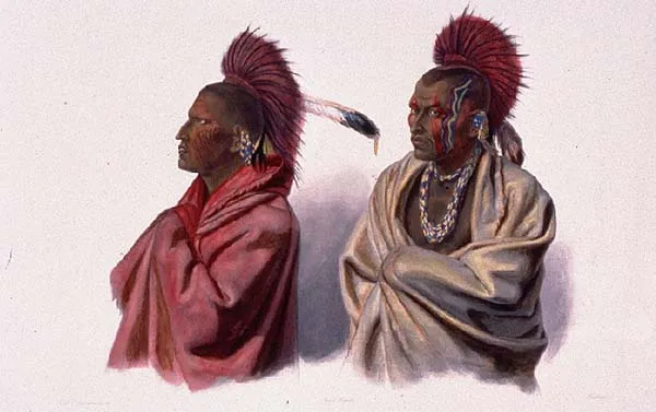
The people living at the Forks when Europeans and Americans arrived were Anishinaabe. That word covers the Ojibwe (also written Chippewa), the Odawa (Ottawa), and the Potawatomi, three nations bound by language, kinship, and an alliance called the Three Fires Confederacy. The Saginaw Chippewa Indian Tribe’s Ziibiwing Center tells this history in the tribe’s own voice: a long migration westward from the Atlantic coast, the formation of the Three Fires in the Great Lakes in the 1200s and 1300s, and ancestors who lived in eastern Michigan for hundreds of years before European settlers appeared. The modern tribe descends from three bands of Ojibwe, the Saginaw, Black River, and Swan Creek bands.
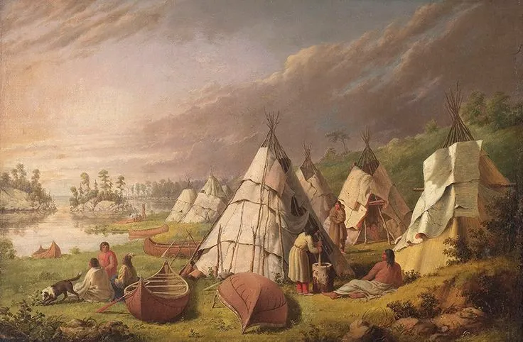

French missionaries and traders reached the Saginaw country in the late 1600s. The Jesuit Henri Nouvel visited Saginaw in the mid-1670s, about a generation before Detroit was founded, and a later history records Ojibwe winter hunting along the Chippewa River in 1675 and 1676.
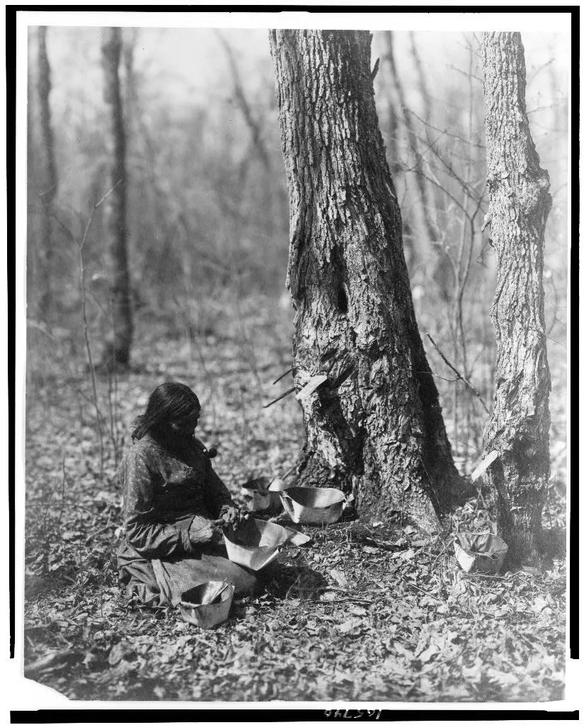
Life followed the year. Families gathered in larger summer settlements along the rivers to fish and plant corn, beans, and squash, then dispersed in fall and winter to hunt and trap. Late winter meant the sugar bush, where families tapped maples and boiled sap down into sugar stored in birchbark containers. Homes were wigwams of bent saplings covered with bark or mats, light enough to rebuild at each camp. Maple sugar mattered enough that the United States wrote the right to keep making it into the 1819 treaty, discussed below.

Archaeology at the Nature Center has found that era too. The Cater site, on the south bank of the Chippewa, holds an Ojibwe occupation dated to about 1800 to 1830, followed by a settler homestead from about 1840. In 1999, excavators found a second early-nineteenth-century Ojibwe home site about 150 meters away. These are among the few places in the county where the households of the Forks can still be studied directly.
The Sauk Story: Tradition and Evidence
Ask about Native history in this part of Michigan and someone will tell you about the Sauk. The story, written down by nineteenth-century county historians, says the Sauk once held the Saginaw Valley and that the Ojibwe and Odawa drove them out in a series of attacks, with some versions placing the decisive fighting around 1640. In this telling, Saginaw means “place of the Sauk.” Midland has its own chapter. The history prepared for Midland County’s 1950 centennial places a final battle between the Sauk and the Chippewa at the river bend called the Ox-Bow, about two and a half miles west of downtown, and dates it to 1833. Popular accounts of the Oxbow district still repeat it.
The evidence is thinner than the story. Historian Jeremy Kilar found little archaeological evidence that the Sauk lived in the Saginaw area, and he traced part of the legend to a mapping error: French explorer Samuel de Champlain, who never visited Michigan, placed the Sauk on the west shore of Lake Huron when his informants meant the west shore of Lake Michigan, and later mapmakers copied the mistake. Kilar also suggested that bones on Saginaw’s “Skull Island,” long described as Sauk battle dead, were more likely the remains of local smallpox victims. The 1833 date for a battle at Midland’s Ox-Bow is very hard to reconcile with the documented record. By 1832 the Sauk were fighting the Black Hawk War in Illinois and Wisconsin, hundreds of miles away.

The story still carries weight. Saginaw Valley Ojibwe oral tradition did speak of the Sauk, and an 1880 county history recorded that local Ojibwe regarded parts of the valley as haunted by Sauk spirits. The fairest summary is this: a conflict tradition is real and old, its details are uncertain, and the Midland version with an 1833 date should be treated as legend until someone produces evidence for it.
1819: The Little Forks Reserve
After the War of 1812, Britain withdrew its support for its Native allies in the Great Lakes, and the United States moved quickly to acquire land. In September 1819, Michigan territorial governor Lewis Cass came to Saginaw to negotiate with the Ojibwe. The talks took thirteen days. According to Central Michigan University’s Clarke Historical Library, a young Ojibwe spokesman named Ogimagegetoo told Cass the people had come to make peace and had no intention of surrendering land, and a second meeting nearly turned violent. Traders with ties to both sides, especially Jacob Smith, worked behind the scenes, and the negotiations moved forward only after the Ojibwe agreed among themselves on which lands they would keep.
The Treaty of Saginaw was signed on September 24, 1819. It ceded more than four million acres, roughly a third of the Lower Peninsula. In return the United States promised an annuity of $1,000 a year in silver, “for ever,” and confirmed the right to hunt and make maple sugar on the ceded land while it remained federal property.
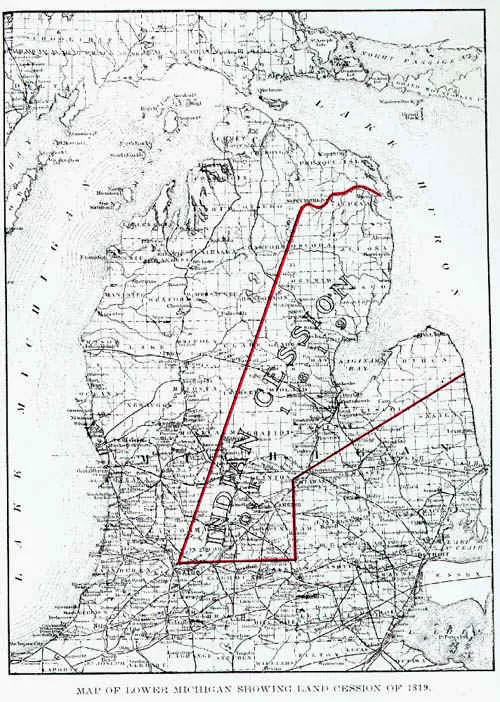

The treaty also set aside reserves where the Ojibwe would continue to live. One line in it is Midland’s first appearance in an American legal document: “One tract, of six thousand acres, at the Little Forks on the Tetabawasink river.” Tetabawasink is the Tittabawassee, and the courthouse marker identifies the Little Forks as the site of downtown Midland. A second 6,000-acre reserve sat downstream at “the Black Bird’s town, on the Tetabawasink river,” which the 1950 centennial history places near the Midland and Saginaw county line. For eighteen years, the land under downtown Midland was, by treaty, reserved Ojibwe land.
Traders at the Forks
The fur trade connected the Forks to the wider world. Louis Campau opened a trading post at Saginaw in about 1816, and in 1827 Gardner and Ephraim Williams began trading there as agents of John Jacob Astor’s American Fur Company. By the late 1820s the company operated a post at the Forks under the direction of the Saginaw post, buying furs from Ojibwe trappers, and the Campau family of Detroit ran an independent post at the same location. The state marker dates the first trading post near the courthouse site to 1831.
The fur trade tied Native and newcomer families together, sometimes literally. The 1819 treaty itself granted land to the children of Ojibwe women and traders. At Midland, the clearest example is Henry C. Ashmun, the county’s first prosecuting attorney, who chose the courthouse site in 1856. His father, Samuel Ashmun, was a fur trader and legislator at Sault Ste. Marie, and his mother, Nancy Keneesequa, was the daughter of an Ojibwe leader. The 1950 centennial history adds that Henry Ashmun married Me-gon-gay-wan, daughter of a Chippewa leader named Pay-mos-ega. The man Midland’s centennial writers called the father of the city carried Ojibwe heritage.
1837: The Reserve Is Sold
The reserves did not last. On January 14, 1837, at Detroit, Saginaw Ojibwe leaders signed a treaty with Henry Rowe Schoolcraft that ceded about 102,400 acres of reserved land, including “six thousand acres at the Little Forks, on the Tetabwasing river.” The United States would survey and sell the land, invest the net proceeds, and pay the tribe the interest. The bands also agreed to move west once a suitable location was found.
That same winter, settlement began. In February 1837 John Wyman came up the river from Saginaw and built a log house near the Forks. When Wyman died in 1875, the Midland Times wrote that there had been no other white settler in the county when he arrived, that his nearest white neighbor lived ten miles downriver, and that a large settlement of Indians in the immediate vicinity were for a long time his only neighbors. Within a few years more settlers followed, and the Forks began its long change into a lumber town.
These were devastating decades for the Saginaw bands. Smallpox reached the valley more than once, settlement pressure grew, and the Methodist missionary George Bradley, who worked with the Ojibwe for decades, later described a people worn down by land loss, disease, and alcohol.
From the Forks to Isabella
Removal west was promised in 1837 and never fully carried out. Instead, the Saginaw, Black River, and Swan Creek bands pressed to stay in Michigan. Treaties signed in 1855 at Detroit and in 1864 at Saginaw established the Isabella Indian Reservation near Mount Pleasant, more than 130,000 acres, divided into individual allotments. The tribe’s own history describes what followed: delayed annuities, hunger, and lumbermen eager for the white pine on allotted land. Of more than 1,500 allotments issued in the late 1800s, only a handful remained in tribal members’ hands by 1934. Under the Indian Reorganization Act, the tribe adopted a constitution and elected its first tribal council in 1937. Today the Saginaw Chippewa Indian Tribe of Michigan is headquartered in Mount Pleasant, upstream on the Chippewa River from the Forks, and in 2004 it opened the Ziibiwing Center of Anishinabe Culture and Lifeways to tell its history in its own words.
Back at the Forks, Midland County was organized in 1850 with 65 residents, and in 1858 the settlement became the Village of Midland. Its story from there belongs to the lumbermen, and that is Part 2 of this series.
What the Forks Remembers
Midland kept part of the memory. When the current county courthouse was built in 1925 and 1926, artist Paul Honoré and Dow chemist Donald Gibb created its exterior murals from a magnesite stucco made from Midland’s own brines. The murals show life-sized Indians, traders, and lumbermen, and a mural in the circuit courtroom depicts an Indian council. A century later they still face West Main Street, a block from where the Little Forks reserve once began.

The rest of the record is quieter: a park built over an archaeological site, river names that outlived the treaty that sold the land, and a few households excavated on the banks of the Chippewa. Midland began as an Anishinaabe place. Knowing that changes how the Tridge looks the next time you cross it.
Next in the series: how the Forks became the Village of Midland. If you want more Midland history, or you are thinking about buying or selling here, I write about this community every week on this site, and you can reach me directly.